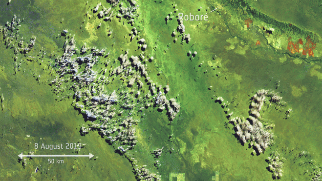
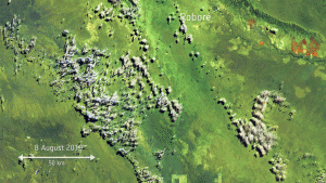
Copernicus Sentinel-2 collected images of wildfires on the border between Bolivia, Paraguay and Brazil.
Thousands of fires have broken out in the Amazon rainforest. Satellite data show that there are almost four times as many fires this year compared to the same period last year. Apart from Brazil, parts of Peru, Bolivia, Paraguay and Argentina have also been affected.
While forest fires normally occur in Brazil’s dry season, which runs from July to October, the unprecedented increase is reported to come from both legal and illegal deforestation that allows land to be used for agricultural purposes. Rising global temperatures are also thought to be making the region more susceptible to fire.
The Amazon basin is the world’s largest tropical rainforest, spanning four countries and is home to millions of plants and animals. It is estimated to produce up to 20% of the world’s oxygen—hence the region being called “the lungs of the world”—and is crucial for helping to regulate global warming, as the forests absorb millions of metric tons of carbon emissions every year.
Using Copernicus Sentinel-3 data, almost 4,000 fires were detected from Aug. 1-24, 2019, while last year there were far fewer during the same period, just 1,110 fires.