Asian Surveying & Mapping
Breaking News
Ecolab and ITE partners to harness water management knowledge for Singapore data center engineers
SINGAPORE, 29 APRIL 2024 – Nalco Water, an Ecolab...
NASA releases satellite photos of Dubai and Abu Dhabi before and after record flooding
NASA released photos of parts of Dubai and Abu...
Singapore releases 10-year Geospatial Master Plan
Singapore has launched its new Geospatial Master Plan (2024–33),...
Japan announces plans to launch upgraded observation satellites on new flagship rocket’s 3rd flight
TOKYO (AP) — Japan’s space agency announced Friday a...
Tesla China partners with Baidu for maps to clear FSD hurdle
Amidst Elon Musk’s unannounced trip to Beijing, China this...
ESA opens ideas factory to boost space innovation in Austria
A centre to innovate the design and manufacture of...
Japan’s space agency sets June 30 as third launch date for H3 rocket
The Japan Aerospace Exploration Agency (JAXA) announced Friday that...
S. Korea launches nanosatellite for Earth observation
SEOUL- A South Korean nanosatellite was launched into orbit...
Australian Space Agency funds development of aerospace-grade GNSS receiver
The Australian Space Agency has funded the development of...
Continuity risks for Australian EO data access
A new report details the widespread use of Earth...
  • Jun 18, 2019
  • Comments Off on Complete Australian Vineyard Map Opens Doors to Global Regions
  • Feature
  • 954 Views

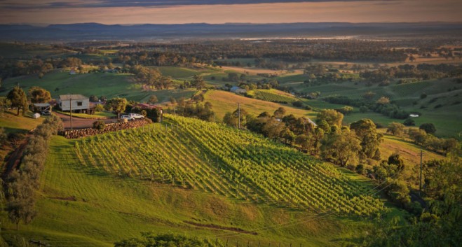
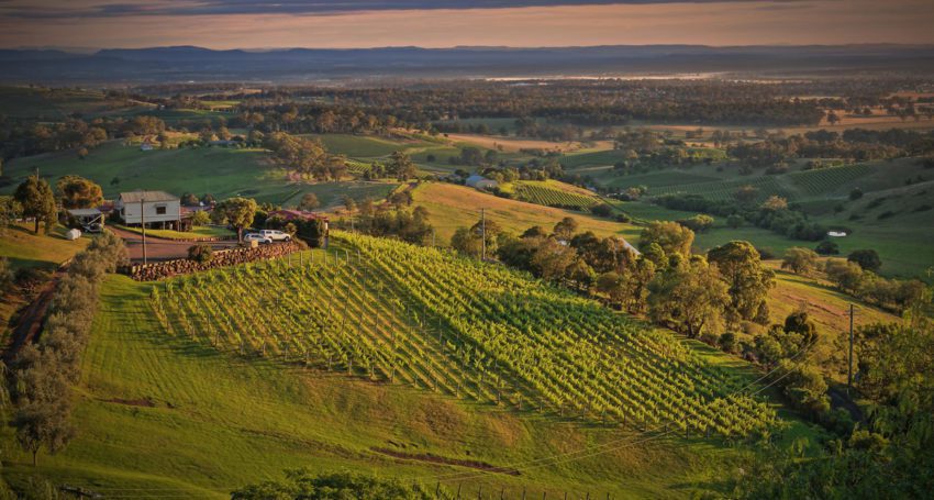
Developed by Consilium Technology in Adelaide, South Australia, the Geospatial Artificial Intelligence for Agriculture (GAIA) analysis algorithm scans high-resolution satellite images of Australia’s wine regions to identify exactly where vineyards are located and how many vine rows are planted.

Funded by Wine Australia, the scan is the first of its kind in the world and replaces the old Australian Bureau of Statistics paper-based sector survey, last published in 2015.

The locations of all 75,961 Australian vineyard blocks detected have been mapped, providing information that can be used for emergency biosecurity responses.

The new method has also measured vine row length, making it possible to assess planting densities by GI region and subregion for the first time.

The multispectral imagery from Maxar’s WorldView-2 satellite and GAIA technology can also be used to provide insights into vine health such as assessing weather-related damage.

Consilium Technology has so far been working in a private Beta with 24 customers including Treasury Wine Estates, DeBortoli Wines, Brown Family Wine Group and a number of viticultural consultancies.